We’d been driving through a constant drizzle for about an hour, following Cove Creek Road as it winds northward along the edge of the Smoky Mountains out of Maggie Valley, NC. The nearest blacktop was miles behind, and as the road transitioned to Old Cataloochee Turnpike at the edge of the national park, its surface also changed: from gravel to dirt or, as was the case today, slick mud. The road crested here and, after a couple more miles of soggy switchbacks, ended in an intersection with…pavement. I guess the dirt road thing is meant to weed out the unserious.
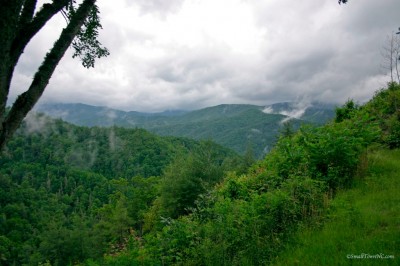 Just ahead through a break in the trees we got our first glimpse of Cataloochee Valley. One of the most remote areas of the park, its roads are mostly paved but it is only reachable by two unpaved mountain roads. One, the access from the North Carolina side, we had just traversed. The other, which heads north into Tennessee, would take us out later in the afternoon.
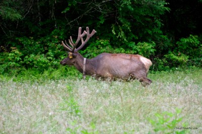
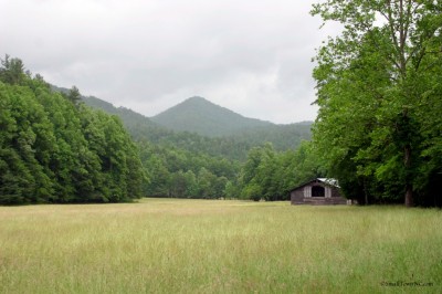
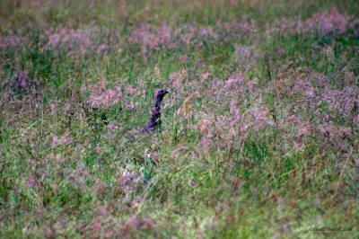 The valley was once home to the Smokies’ largest settlement. In addition to the region’s ubiquitous agrarian economy, before the park’s formation Cataloochee boasted a growing tourism industry due to its abundant hunting and fishing. Now it is inhabited by a couple park rangers and a variety of wildlife. Wild trout still fill its streams, prey for the occasionally seen black bear—and rumored mountain lions—which roam the area. Look carefully through the fields and you can also spy the bobbing heads of wild turkeys strutting about here and there. If you’re lucky—we were—you may come across the valley’s elk. Reintroduced to the valley in 2001, the herd has grown from 25 to about 150.
 As the sun came out we drove to the end of the main road, which turns back to gravel as it
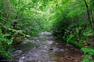 crosses Palmer Creek a bit upstream of its junction with Rough Fork. These later merge with Caldwell Fork to form Cataloochee Creek, which meanders through the valley on its way to Waterville Lake. Originally stocked by the valley’s residents luring fishermen to fill their lodges, these streams now teem with trout “gone native”—a prize for the campers we saw wading around the bend from the bridge.
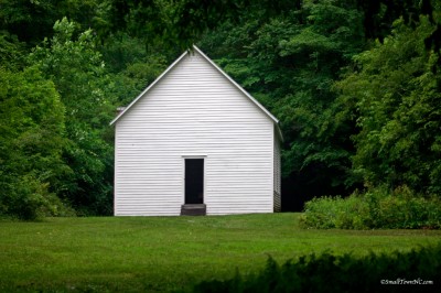 Just on the far side of the creek sits the Beech Grove School, nestled in a grove of what I assume are beeches. In its heyday the valley filled three schools. This is the only one left standing…empty and quiet. As I peered inside, my boots tramped out a poignant echo of the bustling energy of yesteryear’s children. But the memories surrounding the school aren’t merely nostalgic. Its legendary origin is rather humorous.
By 1900, the population of Cataloochee had grown to 764. The Cataloochee School was too small to handle the growing population, and in 1906 the township sent a delegation consisting of Hiram and George Caldwell and Steve Woody to Waynesville to demand a newer, larger school. Officials in Waynesville rejected them, however, claiming they didn’t pay enough taxes. On the way home, the three drank a bottle of whiskey, and decided to burn down the schoolhouse. After removing the furniture, they set the building ablaze, and moved classes to the old Caldwell cabin. They then re-petitioned the government in Waynesville, claiming their school had burned down, and asked for a new one. Due to North Carolina’s mandatory attendance laws, the government had no choice but to comply. [Hattie Caldwell Davis, Cataloochee Valley: Vanished Settlements of the Great Smoky Mountains (Alexander, N.C.: Worldcomm, 1997)]
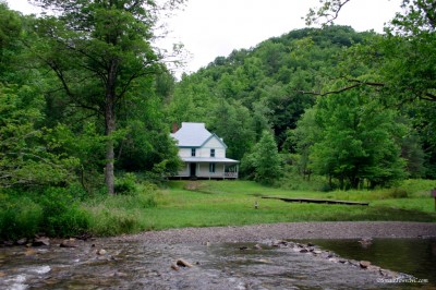 Farther upstream along Rough Fork sits the Caldwell House. The largest remaining home in the valley, it has a shingled roof and a porch which wraps around three sides. It was one of the first modern framed homes in the valley, with exterior weatherboards and wood-paneled interior walls. Just across the stream sits Hiram Caldwell’s barn with a commanding view of the Big Cataloochee valley—looking back downstream toward the schoolhouse.
 With rain returning, we retraced our route back through the valley. We wanted to make it to
 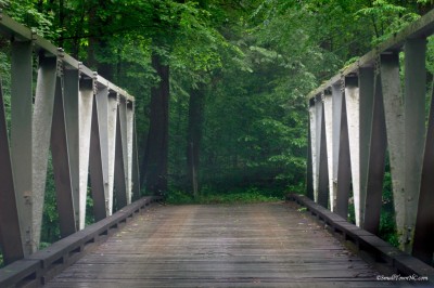 Carver’s Apple House Restaurant in Cosby, TN, for dinner. I’m not normally one to order fried chicken, but Carver’s has the best I’ve ever tasted. I also, however, wanted to see the road leading north out of the valley. We crossed over Cataloochee Creek on a one-lane, steel-beamed bridge. Paved on the valley side and dirt/mud on the other, the bridge itself is surfaced in wood. Well-maintained, I might add.
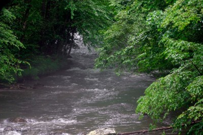
Half-way across I had to pause to snap a shot of the creek. Swollen from the week’s deluge, it was running its banks in a number of places visible from the road. Beautiful, yes, but mountain water is still a tad chilly for this desert rat. Time to move on.
The Old Cataloochee Turnpike twists and turns northward back up into the mountains. Unlike the southern entrance to the valley, this road is not well-graded, though it starts out
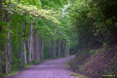 smooth enough. Before long we were running over rough, pitted road. This, in turn, gave way to tight corners with deep grooves cut by steady rivulets flowing across the way down the hills on either side. Not a road for cars. We slipped the Xterra into 4-wheel mode, and even then traction was dicey as we were bumped and jarred all the way up the pass. Slowed to a crawl, it took a couple hours to cover the 27 miles to Cosby.
Worth it? Oh, yes. Oh, my, my, yes. That fried chicken was the perfect cap to a great day exploring the lesser-seen side of the Smokies!